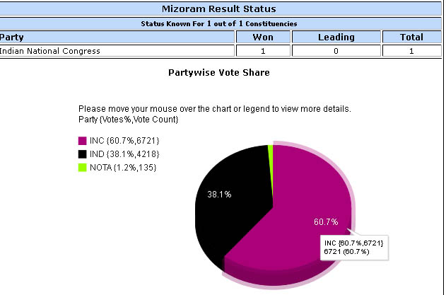
lawngtlai district mizoram assembly elections 2013
mizoram assembly elections2013 voterslist

lawngtlai district mizoram assembly elections 2013 constituency map
Lawngtlai district is one of the 8 districts of Mizoram state in India. The district is bounded on the north by Lunglei district, on the west by Bangladesh, on the south by Myanmar and on the east by Saiha district. The district occupies an area of 2557.10 km². Lawngtlai town is the administrative headquarters of the district. read more here is available all details of lawngtlai district mizoram assembly elections 2013 latest news, photos,videos live results updates etc...
Please click here for tuichawng mizoram election 2013 news, photos, results,maps,videos
Please click here for lawngtlai west mizoram election 2013 news, photos, results,maps,videos
Please click here for lawngtlai east mizoram election 2013 news, photos, results,maps,videos
